
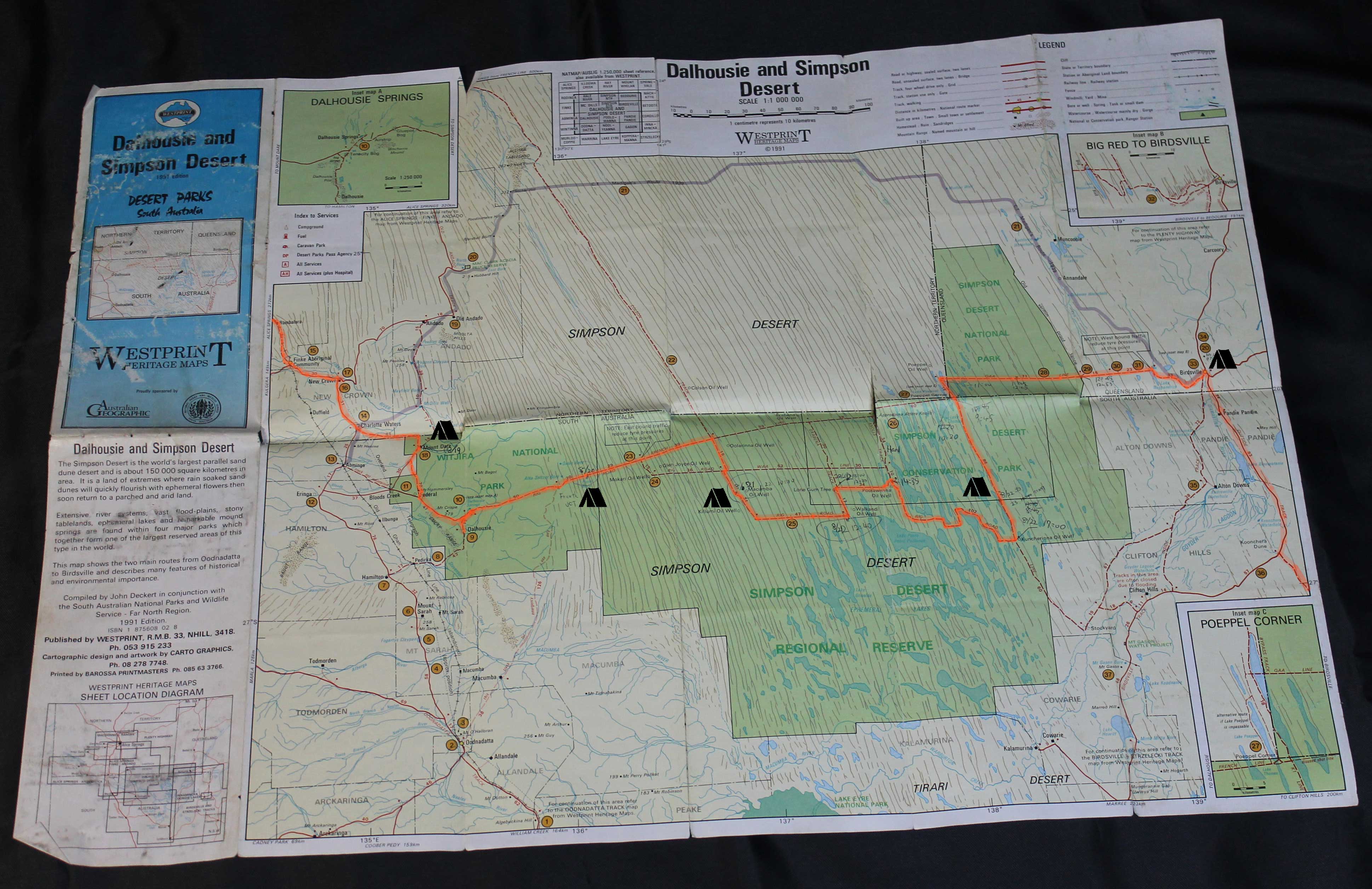
1991 edition.
Click to Detail.
At the time of 1992,
There was already such a detailed map in the desert
which Japanese ran a risk, and tried the passage.
1992擭摉帪丄偙偺傛偆側惓妋偱徻嵶側抧恾偑婛偵懚嵼偟偰偄偨丅
偲偄偆偙偲偑廳梫偲巚偄傑偡丅
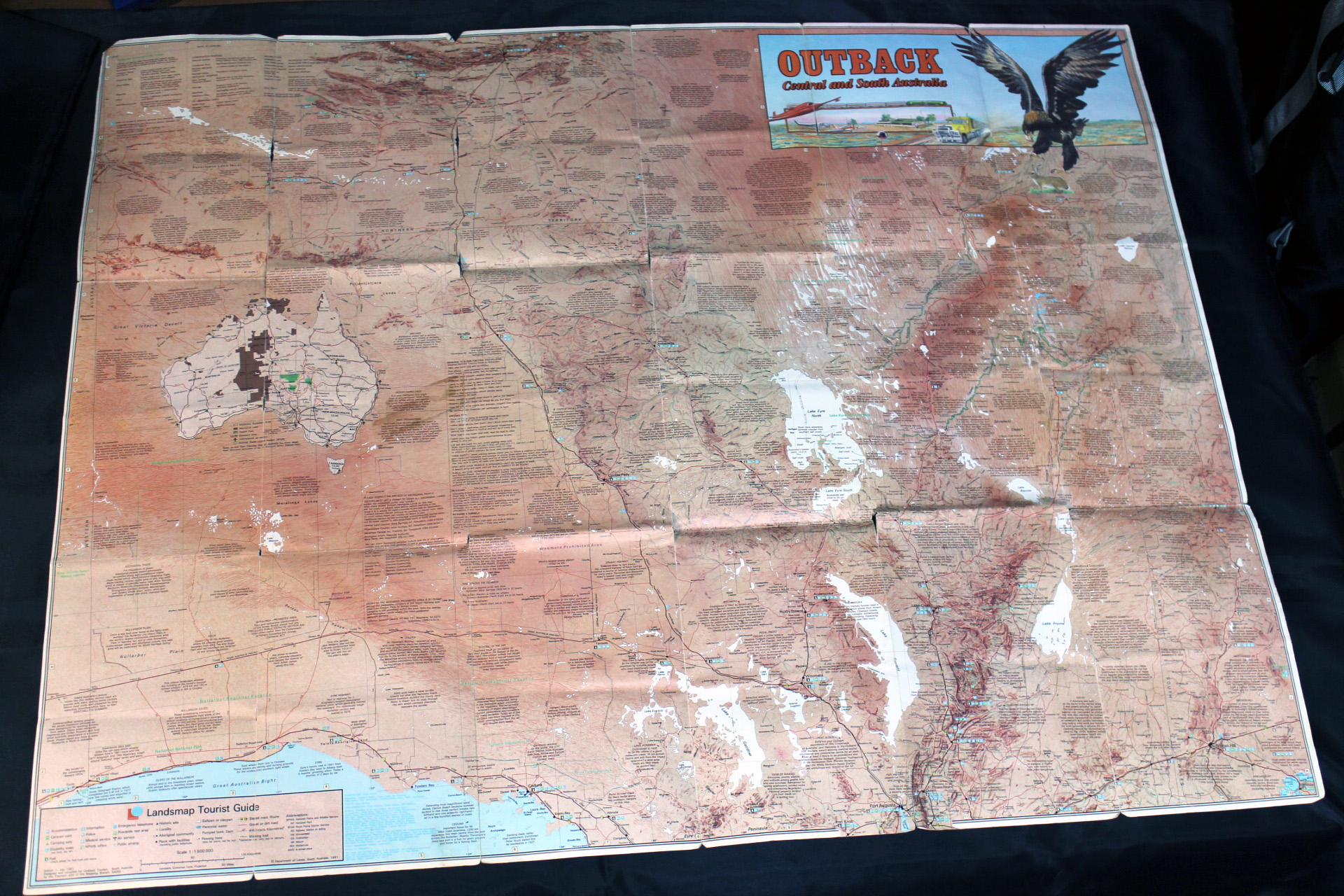
Central and South Asutralia.
Department of Lands. South Australia, 1991.
Click to Detail.
There was imagining it from the picture of the dune written on this map
what kind of place a course to pass through the desert was.
偟偐偟丄偙偺抧恾偵彂偐傟偨嵒媢傗墫屛偺奊偐傜丅
偦偙偑偳傫側応強側偺偐傪憐憸偟偰堷偒婑偣傜傟傞恖乆偑偄傞帠傕妋偐偱偡丅
偦傟偼丄崙愋傗庤抜側偳條乆偱偡偑丅恖偺杮擻偱偟傚偆丅
僀儞僞乕僱僢僩傕WEB傕柍偐偭偨1992擭摉帪偼偙偺抧恾偩偗偑偨傛傝偱偟偨丅
偦偟偰丄偝傜偵僶乕僋仌僂傿儖僘摍偺扵専戉偺帪戙偵偼偙偺抧恾傕懚嵼偟側偐偭偨丅
撪棨偵奀傗屛偑偁傟偽丄偙偺崙傕堘偭偨巔偵側偭偰偄偨偱偟傚偆丅
偱傕丄偙偺壗傕側偄峀戝側戝抧偼丅
変乆擔杮恖偺傛偆偵嶳傗椢偵宐傑傟偨崙搚偱堢偭偨柉懓偵偼丄
旤偟偔丄慺惏傜偟偄戝帺慠偲姶偠傞偙偲偑偱偒傞偺偐傕偟傟傑偣傫丅
Central and South Asutralia.(back side)
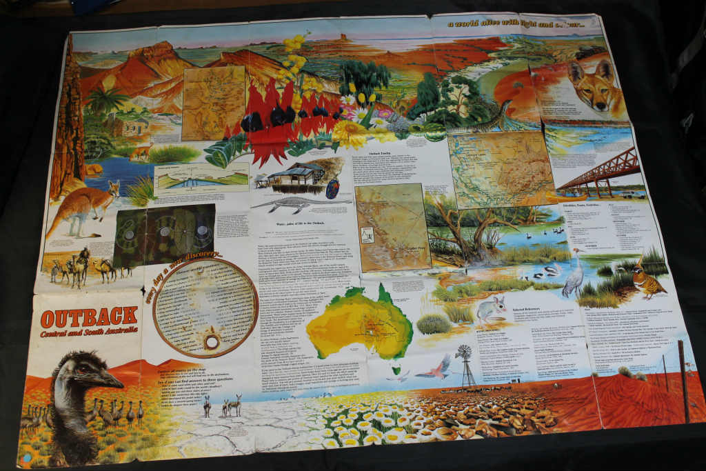
Click to Detail.
some piece of maps.
The French Line.
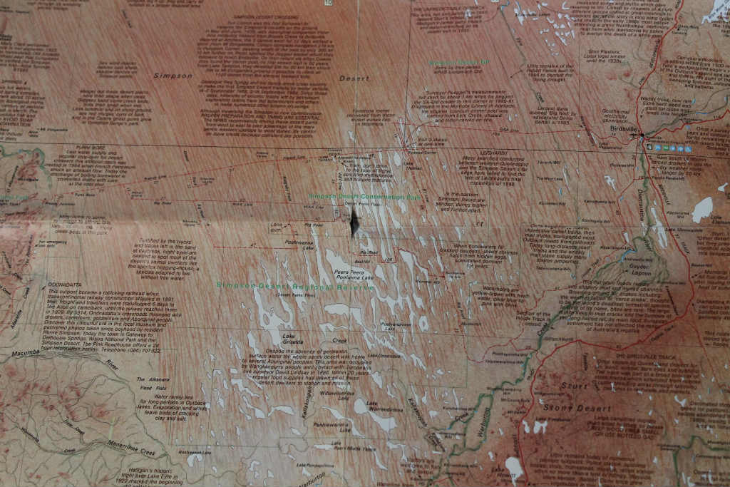
Lake eyre
Dalhousie
Mound Spring
Desert Tracks
1992擭摉帪丅
婛偵嵒敊偺撲偼 夝柧偝傟偮偮偁傝傑偟偨丅
Click to Detail.
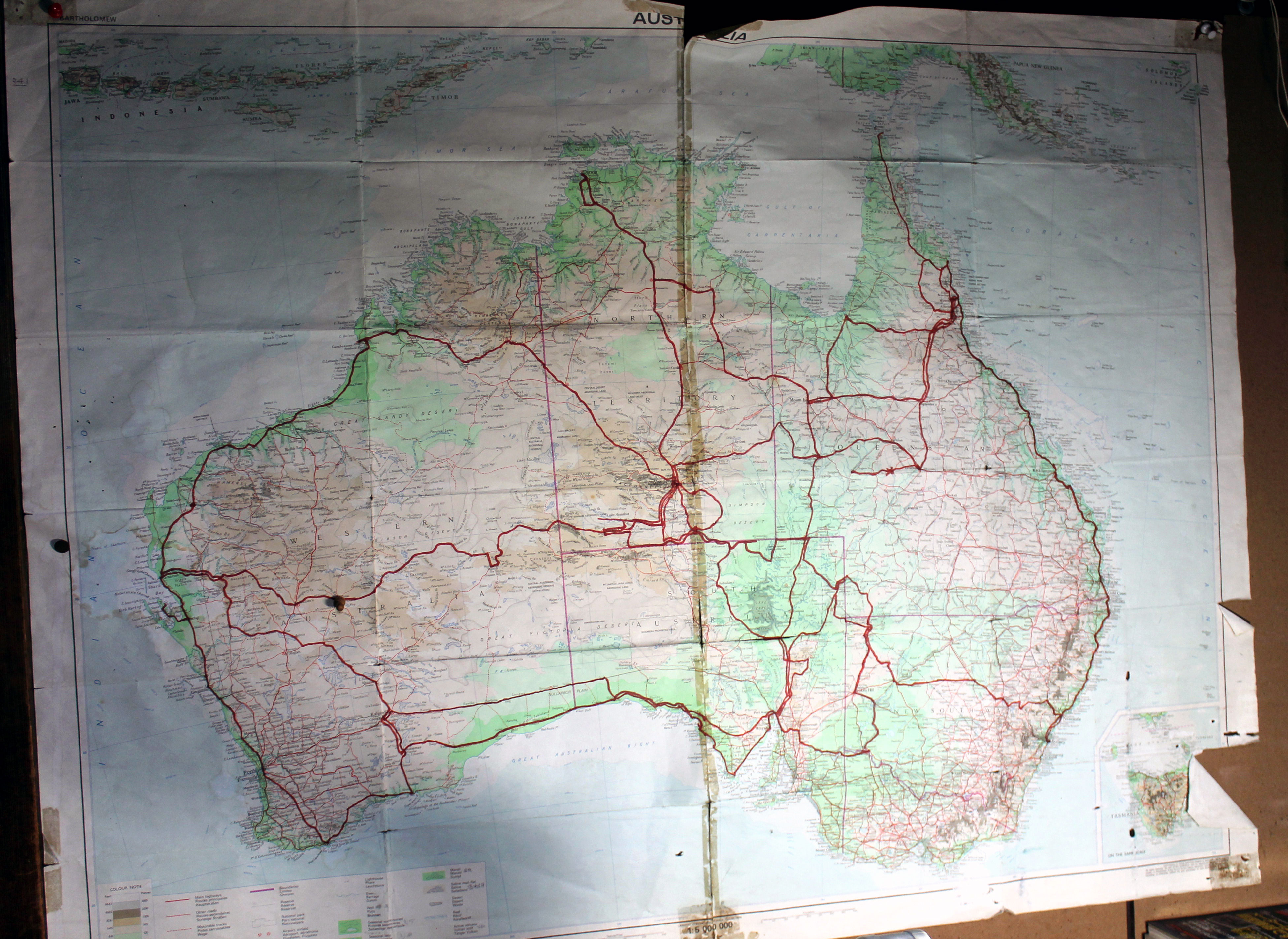
50,000km, 11 months by motorcycle.
HONDA XR600R.
10/16/1991 to 09/10/1992.
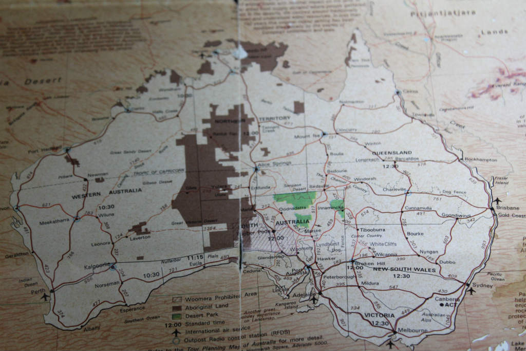
Sydney, Cape york, Birdsville track, Nullarbor Plain, Gunbarrel highway,
Alice springs, Tanami track, Western australia, Mildura,
Cameron cnr, Innamincka, Williams creek, Dalhousie hot springs,
Yulala, Alice springs, Darwin, Cairns, Alice springs, French line,
birdsville, Innamincka, Cessnock, Sydney.
